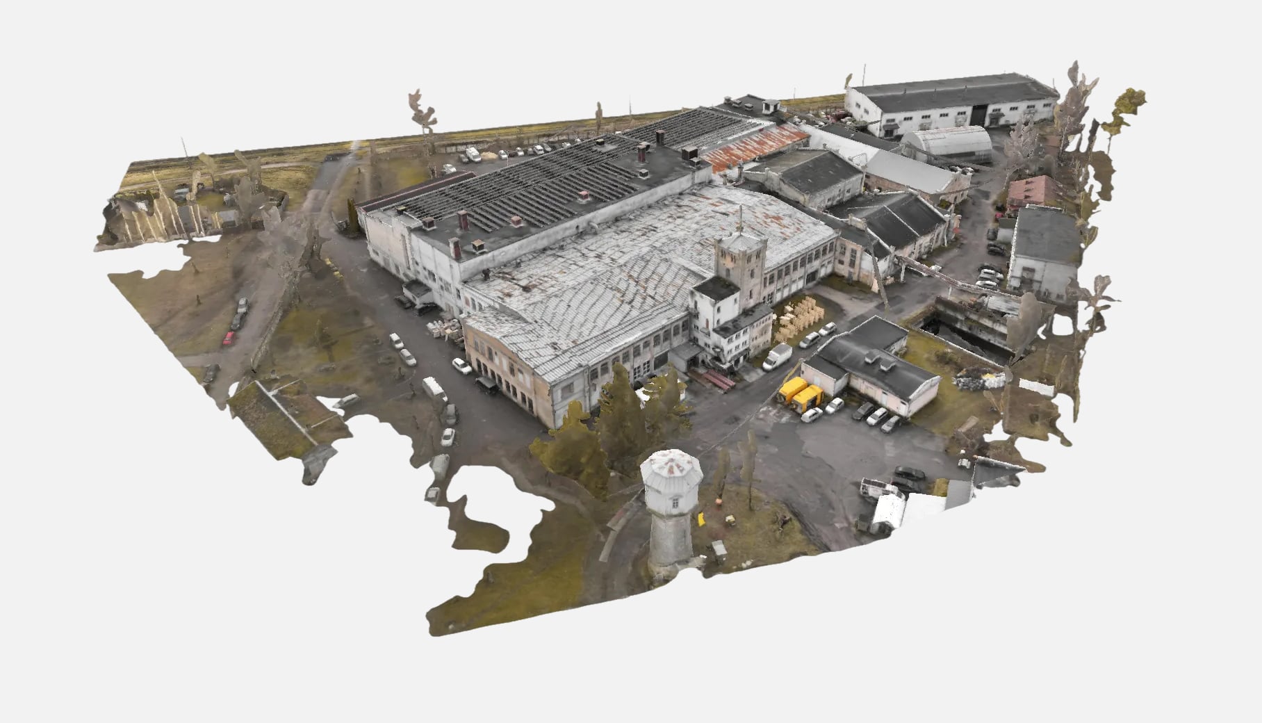
AirScout performs photogrammetric surveys using a combination of aerial and ground-based sensors.
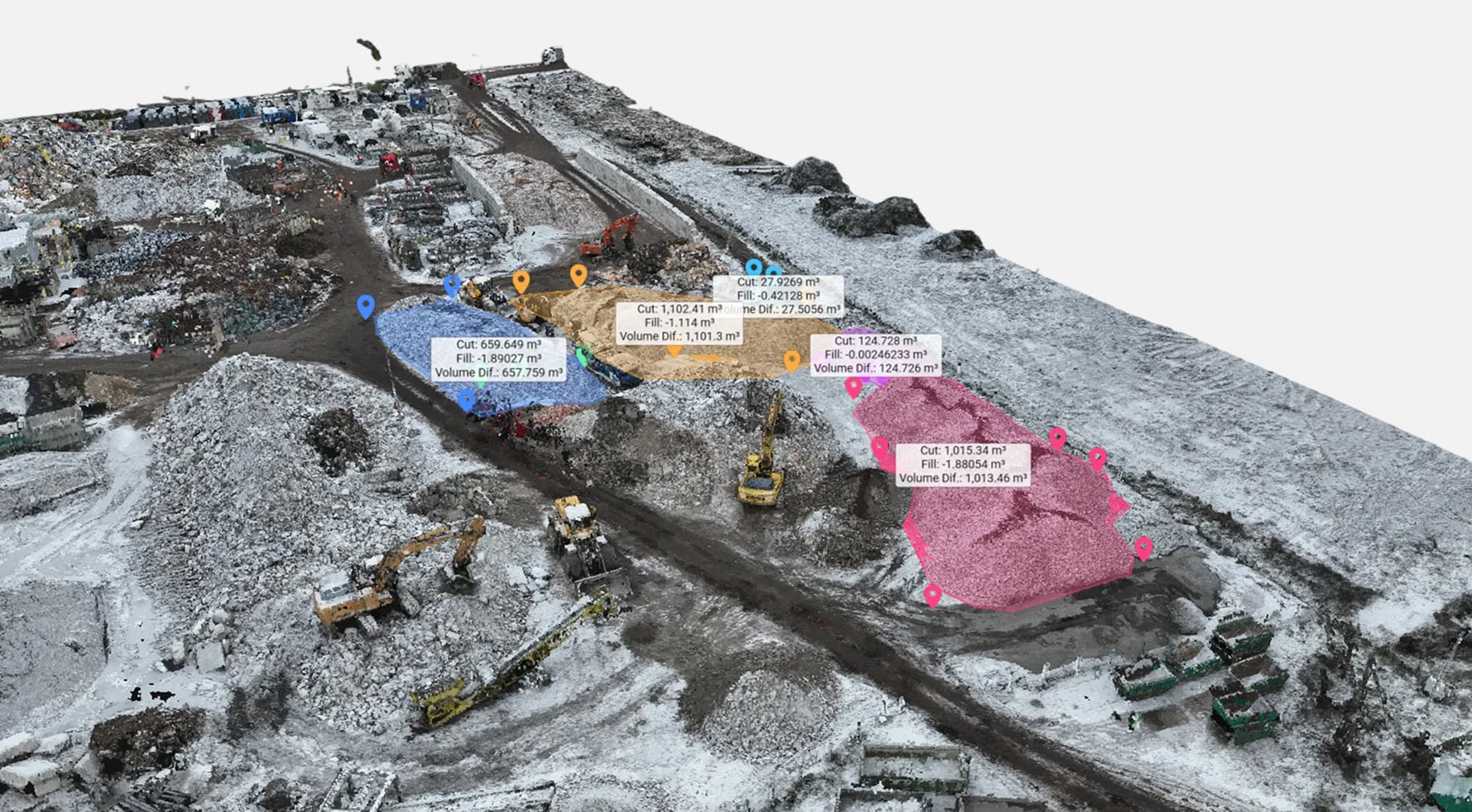
High-overlap RGB imagery is complemented by laser scans and ground control data to achieve centimeter-level accuracy across large or complex sites.
Data is processed in Pix4D Mapper, RealityCapture, or Agisoft Metashape. All outputs are georeferenced in the client’s local coordinate system and optimized for integration into CAD, BIM, and GIS environments
Applications
Deliverables


